Thursday, August 30, 2012

Rare Find: Feathered Dinosaur Feasted On Flying Food

Holotype of Sinocalliopteryx gigas. (Credit: Xing et al., Abdominal Contents from Two Large Early Cretaceous Compsognathids (Dinosauria: Theropoda) Demonstrate Feeding on Confuciusornithids and Dromaeosaurids. PLoS ONE, 2012; 7 (8): e44012 DOI: 10.1371/journal.pone.0044012)


ScienceDaily (Aug. 29, 2012) — University of Alberta researchers found evidence that a feathered, but flightless dinosaur was able to snag and consume small flying dinosaurs.

The U of A paleontology team found the fossilized remains of three flying dinosaurs in the belly of a raptor-like predator called Sinocalliopteryx. Sinocalliopteryx was about two meters in length and roughly the size of a modern-day wolf.

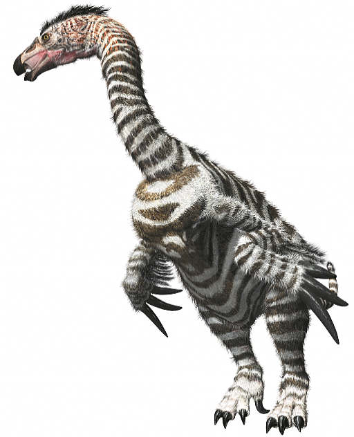
Sinocalliopteryx's flying meals were three Confuciusornis. Confuciusornis was one of the earliest birds and had a crude version of a modern bird's skeleton and muscles. The researchers say such primitive birds were probably limited to slow take-offs and short flights.
According to the researchers, this is the first time a predator has been linked to the killing of multiple flying dinosaurs.

Scott Persons, a U of A paleontology student and research coauthor, says Sinocalliopteryx may have used stealth to stock the flyers. "Sinocalliopteryx didn't have wings or the physical tools needed to be an adept tree climber," said Persons.

Persons explains Sinocalliopteryx had feathers or hair-like fuzz covering its body creating a level of insulation that helped maintain a warm body temperature and high metabolism that required a lot of food to fuel.

"The fact that this Sinocalliopteryx had, not one, but three undigested birds in its stomach indicate it was a voracious eater and a very active hunter," said Persons.

This find was made in China's Liaoning province, and U of A researchers analyzed stomach contents of a second Sinocalliopteryx fossil discovery from that area. The researchers identified this Sinocalliopteryx's last meal as a Sinornithosaurus, a small feathered meat-eater about the size of a house cat that may have been able to fly or glide short distances.

"Sinornithosaurus is a relative of Velociraptor which means this is the first direct evidence of a raptor becoming another predatory dinosaur's meal," said Persons.


Story Source:
The above story is reprinted from materials provided by University of Alberta, via EurekAlert!, a service of AAAS.
Note: Materials may be edited for content and length. For further information, please contact the source cited above.

Journal Reference:
  1. Lida Xing, Phil R. Bell, W. Scott Persons, Shuan Ji, Tetsuto Miyashita, Michael E. Burns, Qiang Ji, Philip J. Currie. Abdominal Contents from Two Large Early Cretaceous Compsognathids (Dinosauria: Theropoda) Demonstrate Feeding on Confuciusornithids and Dromaeosaurids. PLoS ONE, 2012; 7 (8): e44012 DOI: 10.1371/journal.pone.0044012

University of Alberta (2012, August 29). Rare find: Feathered dinosaur feasted on flying food. ScienceDaily. Retrieved August 30, 2012, from http://www.sciencedaily.com­ /releases/2012/08/120829171943.htm

Decline in Breeding Chinstrap Penguins in Antarctic Peninsula Confirmed

Chinstrap penguins at Baily Head, Deception Island. (Credit: Copyright Thomas Mueller)
 
ScienceDaily (Aug. 29, 2012) — In a paper published this week in the journal Polar Biology, researchers from the Antarctic Site Inventory confirm significant declines in the breeding population of chinstrap penguins in the vastly warming Antarctic Peninsula, where it's warming faster than, or as fast as, any other place on Earth.

New results and analyses stem from fieldwork conducted in December 2011 at Deception Island, one of the most frequently visited locations in Antarctica.

Overseen by Ron Naveen, founder of the nonprofit science and conservation organization, Oceanites, Inc., the Deception Island census effort analyses were undertaken by Dr. Heather Lynch, Assistant Professor of Ecology and Evolution at Stony Brook University, and chief scientist of the Antarctic Site Inventory project.

The Inventory has been collecting and analyzing Antarctic Peninsula-wide penguin population data since 1994, and these new findings have important implications both for the advancement of Antarctic science and the management of Antarctica by the Antarctic Treaty nations.

"Our Deception Island work, using the yacht Pelagic as our base, occurred over 12 days and in the harshest of conditions -- persistent clouds, precipitation, and high winds, the latter sometimes reaching gale force and requiring a lot of patience waiting out the blows," said Naveen. "But, in the end, we achieved the first-ever survey of all chinstraps breeding on the island."

The other Inventory researchers on the team were Steven Forrest (Oceanites, Inc.), Dr. Thomas Mueller (Biodiversity and Climate Research Centre), and Dr. Michael Polito (now at Woods Hole Oceanographic Institute). The scientific effort of the Inventory is supported by the U.S. National Science Foundation and public contributions, and the project's on-the-ground fieldwork at Deception Island was specifically supported by a grant from The Tinker Foundation. The Inventory is the only publicly supported science project working in Antarctica and the only science project tracking penguin populations throughout the entire Antarctic Peninsula region.

The scientific effort of the Inventory is supported by the U.S. National Science Foundation and public contributions, and the project's on-the-ground fieldwork at Deception Island was specifically supported by a grant from The Tinker Foundation. The Inventory is the only publicly supported science project working in Antarctica and the only science project tracking penguin populations throughout the entire Antarctic Peninsula region.

Deception Island is frequently visited and there has been speculation that tourism may have a negative impact on breeding chinstrap penguins -- especially, at Deception Island's largest chinstrap colony known as Baily Head. Previously, Antarctic Treaty-level discussions regarding the management of visitors at Baily Head proceeded in the absence of concrete site-wide census data.
The results and analyses, according to Dr. Lynch, shed new light on the massive changes occurring in this region.

"Our team found 79,849 breeding pairs of chinstrap penguins at Deception, including 50,408 breeding pairs at Baily Head. Combined with a simulation designed to capture uncertainty in an earlier population estimate, there is strong evidence to suggest a significant (>50%) decline in the abundance of chinstraps breeding at Baily Head since 1986/87.

"The decline of chinstrap penguins at Baily Head is consistent with declines in this species throughout the region, including at sites that receive little or no tourism; further, as a consequence of regional environmental changes that currently represent the dominant influence on penguin dynamics, we cannot ascribe any direct link in this study between chinstrap declines and tourism."
The Baily Head analysis was abetted by Dr. Lynch's cutting-edge analyses of high-resolution satellite imagery. Images were available for the 2002/03 and the 2009/10 seasons that suggest a 39% decline over that seven-year period, and which provide independent confirmation of this population decline. Via assistance from the U.S. National Science Foundation and a cooperative effort the University of Minnesota's Polar Geospatial Center, the Inventory continues to demonstrate the use of satellite imagery to analyze and describe environmental change in sensitive habitats.

"We now know," says Naveen, "that two of the three predominant penguin species in the Peninsula -- chinstrap and Adélie -- are declining significantly in a region where, in the last 60 years, it's warmed by 3˚ C. (5˚ F.) annually and by 5˚ C. (9˚ F.) in winter. By contrast, gentoo penguins, the third of these species, are expanding both its numbers and range. These divergent responses are an ongoing focus of our Inventory work effort."

Adds Lynch: "While there has been considerable focus in the policy and management community about the potential impact of tourism on these penguin populations, we cannot forget the overwhelming evidence that climate is responsible for the dramatic changes that we are seeing on the Peninsula. If tourism is having a negative impact on these populations, it's too small an effect to be detected against the background of climate change."


Story Source:
The above story is reprinted from materials provided by Stony Brook University.
Note: Materials may be edited for content and length. For further information, please contact the source cited above.

Journal Reference:
  1. Ron Naveen, Heather J. Lynch, Steven Forrest, Thomas Mueller, Michael Polito. First direct, site-wide penguin survey at Deception Island, Antarctica, suggests significant declines in breeding chinstrap penguins. Polar Biology, 2012; DOI: 10.1007/s00300-012-1230-3

Stony Brook University (2012, August 29). Decline in breeding chinstrap penguins in Antarctic Peninsula confirmed. ScienceDaily. Retrieved August 30, 2012, from http://www.sciencedaily.com­ /releases/2012/08/120829103413.htm

Tuesday, August 21, 2012

Six-ton feathered dinosaurs once flocked in Denali region

Numerous tracks of therizinosaurs were found over the summer.

Therizinosaurs weighed six tons, had a giraffe-length neck, claws like scimitars -- and feathers. Alaska once had a lot of them, said paleontologist Anthony Fiorillo. 

Click to enlarge
Anthony Fiorillo --->

Fiorillo, curator of earth sciences at the Perot Museum of Nature and Science in Dallas, and his colleague Thomas Adams published a paper in the June online edition of the scholarly journal Palaios identifying a single track found in Denali National Park as belonging to the odd plant-eating dinosaur related to Tyrannosaurus rex and the modern chickadee.
In an interview last week, Fiorillo said several more therizinosaur tracks were found in the park over the course of this summer.

Scientists have been baffled by this family of dinosaurs, originally thinking they were something like turtles. The first incomplete specimens came from Mongolia. More fossils were then found in China and North America. The Denali tracks are the first evidence that they were among the ancient reptiles that lived in high latitudes, sometimes called "polar dinosaurs." 

 Anthony Fiorillo, curator of earth sciences at the Perot Museum of Nature and Science in Dallas, works to recover the remains of a horned pachyrhinosaur on the North Slope  in 2006.
Anthony Fiorillo, curator of earth sciences at the Perot Museum of Nature and Science in Dallas, works to recover the remains of a horned pachyrhinosaur on the North Slope in 2006.

The biggest Therizinosaurus is estimated to have stretched 40 feet. Even the smallest member of the family was 7 feet from the tip of its tail to its tiny head. They walked on their hind legs -- very well, as it turns out. Despite those ferocious front-limb talons, which could be a yard long, they seem to have come from a meat-eating species that turned vegetarian. 

The purpose of the Edward Scissorhands-like claws is something of a mystery. They could have been used to scythe leaves or stalks, Fiorillo said. Therizinosaur is Greek for "reaping lizard."
Likewise, "The feathers are the source of a lot of speculation," Fiorillo said. Perhaps they were for display. Perhaps they helped the animal control its body temperature.

For purposes of identifying the Alaska animal as a therizinosaur, however, the important feature is its feet.
In their paper, Fiorillo and Adams document the configuration of the original Denali track, saying, "Four-toed theropod tracks are decidedly uncommon." Theropods are the suborder of dinosaurs to which therizinosaurs belonged. Only two groups have all four toes facing forward, the researchers note as they meticulously eliminate other possibilities. 


In the case of therizinosaurs, all four toes bear some weight. It's a design not unlike the human foot, built for walking rather then springing, perching, swimming or other things feet do.
And walk they did. The Palaios article includes a map showing a possible therizinosaur highway from Lake Baikal in Central Asia to central Canada by way of the Bering Land Bridge. It likely took generations for the clan to travel that far.

The Denali region, on the other hand, may have been a major seasonal migration corridor, similar to those used by the birds and fish that swarm into Alaska during the summer nowadays. It was a place where different species fed and mingled; the therizinosaur tracks were found in the same layer of "bedding plains" as a number of duck-billed dinosaur tracks. It was a family place; different-size prints show adults and juveniles traveling together.

The abundant signs of various dinosaurs and prehistoric birds in Denali suggest to Fiorillo a scene not unlike the African savannah, with the Cretaceous versions of wildebeest and zebra herds eying each other across the plain.
"Alaska is the best place on the planet to study a high latitude ecosystem in deeper geologic time," he said. "We have something we can contribute to the discussion of what a warming Arctic might look like."

"There's so much (paleontological) potential in this state," Fiorillo said. "You never know what's around the corner."
The Denali footprints supply something like a photograph of what was happening in the far North 70 million years ago or more, he said. "We don't have bones. But the tracks give us a component to the biodiversity of the area that we didn't have before."

The therizinosaur isn't the first feathered dinosaur found in Alaska. That honor probably belongs to the small, wide-eyed, big-brained carnivore Troodon, fossils of which were previously found on the North Slope. 

source 

Thursday, August 2, 2012

Become an Antarctic explorer with panoramic imagery


Become an Antarctic explorer with panoramic imagery

In the winter of 1913, a British newspaper ran an advertisement to promote the latest imperial expedition to Antarctica, apparently placed by polar explorer Ernest Shackleton. It read, "Men wanted for hazardous journey. Low wages, bitter cold, long hours of complete darkness. Safe return doubtful. Honour and recognition in event of success." While the ad appears apocryphal, the dangerous nature of the journey to the South Pole is certainly not—as explorers like Roald Amundsen, Robert Falcon Scott and Shackleton himself discovered as they tried to become the first men to reach it.

Back in September 2010, we launched the first Street View imagery of the Antarctic, enabling people from more habitable lands to see penguins in Antarctica for the first time. Today we’re bringing you additional panoramic imagery of historic Antarctic locations that you can view from the comfort of your homes. We’ll be posting this special collection to our World Wonders site, where you can learn more about the history of South Pole exploration.


With the help of the Polar Geospatial Center at the University of Minnesota and the New Zealand Antarctic Heritage Trust, we’ve added 360-imagery of many important spots, inside and out, such as the South Pole Telescope, Shackleton's hut, Scott’s hutCape Royds Adélie Penguin Rookery and the Ceremonial South Pole.

The ceremonial South Pole (View Larger Map)


The interior of Shackleton’s Hut demonstrates the host of supplies used in early 20th century Antarctic expeditions—everything from medicine and food to candles and cargo sleds can be found neatly stored inside. (View Larger Map)

With this technology, you can go inside places like Shackleton’s Hut (pictured above) and the other small wooden buildings that served as bases from which the explorers launched their expeditions. They were built to withstand the drastic weather conditions only for the few short years that the explorers inhabited them, but remarkably, after more than a century, the structures are still intact, along with well-preserved examples of the food, medicine, survival gear and equipment used during the expeditions. Now anyone can explore these huts and get insight into how these men lived for months at a time.


The landscape outside of Robert Falcon Scott’s supply hut conveys just how desolate the area is. For these early explorers, the supply huts were an oasis of warmth and comfort in a cold and inhospitable landscape. (View Larger Map)

This new imagery was collected with a lightweight tripod camera with a fisheye lens—equipment typically used to capture business interiors through the Business Photos program. We worked with this technology because of its portability, reliability and ease-of-use (our Street View trikes wouldn’t be much use in the snow).

The goal of these efforts is to provide scientists and travel (or penguin) enthusiasts all over the world with the most accurate, high-resolution data of these important historic locations. With this access, schoolchildren as far as Bangalore can count penguin colonies on Snow Hill Island, and geologists in Georgia can trace sedimentary layers in the Dry Valleys from the comfort of their desks. Feel free to leave your boots and mittens behind, and embark on a trip to Antarctica.

Posted by Alex Starns, Technical Program Manager, Street View


source