Photo Credit: Jessie Jenkins | Kevin Pettway, the lead environmental specialist at Raytheon Polar Services Co., counts penguins on Seabee Hook to collect data for a revised Cape Hallett ASPA plan, as well as for ongoing Adélie research in Antarctica. Pettway's team conducted the most thorough assessment ever of an ASPA. |
Added protection
Revised ASPA plan for Cape Hallett preserves huge Adélie colony
By Peter Rejcek, Antarctic Sun Editor
Posted April 16, 2010
Kevin Pettway will be the first person to tell you it’s not easy to get to Cape Hallett. But he’ll also tell you the trip is well worth the effort to help protect one of Antarctica’s biological gems.
The journey required the support of a nearby Italian research station, Terra Nova, and a couple of extra nights stuck in a “bare bones” tent camp thanks to the continent’s unpredictable weather.
“Getting out to Hallett is very difficult because it is so far away [from McMurdo Station],” said Pettway, the lead environmental specialist at
Raytheon Polar Services Co. (RPSC) 
.
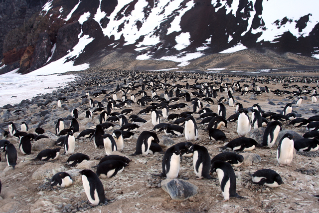
Photo Credit: Jessie Jenkins
The northern limit of the Adélie penguin colony.
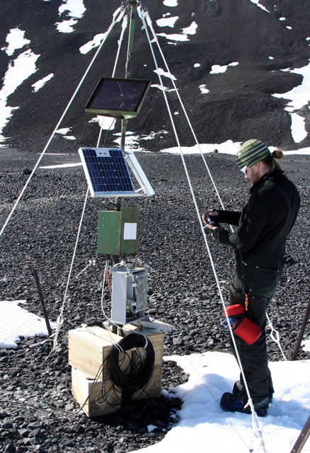
Photo Credit: Jessie Jenkins
Kevin Pettway downloads data from a New Zealand Antarctica soil experiment.
“Having the Italian support was absolutely key to the success of this project,” he added, explaining that the crew at Terra Nova, located about halfway between McMurdo and Cape Hallett, helped move people and cargo by helicopter to the cape, a spit of land surrounded by sea ice eight months of the year.
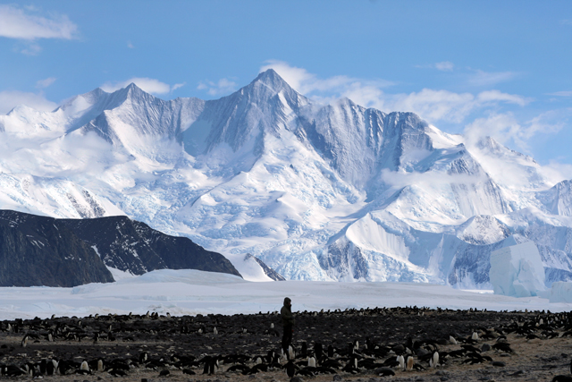
Site of a former joint U.S. and New Zealand research station, Cape Hallett is home to a huge colony of Adélie penguins, and a diverse range of lichens, moss and tiny invertebrates. It’s also become a new model for how the
U.S. Antarctic Program (USAP) 
would like to approach conservation of Antarctic resources in the future.
Cape Hallett first gained special protection under the
Antarctic Treaty system in 1966 at the request of the United States. Following the 1998 implementation of a comprehensive plan called the Protocol on Environmental Protection to the Antarctic Treaty, Cape Hallett became an
Antarctic Specially Protected Area (ASPA) . Each ASPA is associated with a plan designed to manage access and to minimize impacts to the environment.
Pettway and his three-person team spent a week at Cape Hallett to redefine the ASPA boundaries and to survey the various animal populations. The USAP plans to submit a revised ASPA plan for Cape Hallett at the next meeting of the member nations to the Antarctic Treaty in
Uruguay later this year.
“We probably did the most thorough site assessment of an ASPA that’s been done,” said Nate Biletnikoff, manager of RPSC’s environmental engineering department. RPSC provides much of the logistical support for the USAP, which is managed by the
National Science Foundation (NSF) .
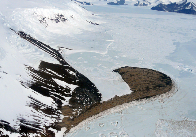
Photo Credit: Kevin Pettway
Seabee hook at Cape Hallett.
RPSC hired a subcontractor,
Environmental Research & Assessment (ERA) , which specializes in creating management plans in polar environments, to help develop the ASPA plan. Two ERA members, Colin
Harris and Rachel Carr, used high-precision GPS technology from Boulder, Colo.-based
UNAVCO to map the boundaries of the penguin colony, which boasts about 64,000 breeding pairs.
“We basically surveyed the entire area,” Biletnikoff said. “This is first time we’ve ever surveyed the spatial extent of a penguin colony to this level of detail.”
Tourism is partly the reason behind the detailed survey, according to Biletnikoff. The
International Association of Antarctic Tour Operators said 322 tourists visited Cape Hallett during the 2008-09 season.
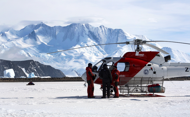
Photo Credit: Jessie Jenkins
The Italian Antarctic program assisted the USAP environmental team with helicopter support.
“It is of high value to Antarctic tour operators in the Ross Sea region because of its high aesthetic values and accessibility,” Biletnikoff said.
While environmental protection has long been a fixture in the management of Antarctica, people have not always treaded so lightly on the continent. The original establishment of Cape Hallett Station on a site dubbed Seabee Hook in 1956 involved the “eviction” of more than 7,500 penguins, including some 3,300 chicks, to clear space for construction.
The colony declined from 62,900 pairs in 1959 to a low of 37,000 pairs in 1968. It has since recovered its former numbers and has started to re-occupy the site of the station, which ceased operations in 1973. The area itself has been cleaned up, and the last structures removed by the Italians in January 2010. Many of the historical artifacts from the station are located at the
Canterbury Museum in Christchurch, New Zealand.
“The colony just keeps creeping forward. [ERA is] anticipating that the colony will fill into the coastline for the most part,” Biletnikoff said.
The new site map for tourist access proposes additional landing sites for boats, he said, to help minimize disturbances to the colony by ensuring operators come ashore at recognizable landmarks.
Square kilometers of updated Cape Hallett ASPA: 0.53 square kilometers
Adélie penguins: 64,000 breeding pairs
South polar skuas: About 232 birds and 250 numbered nests
Other wildlife in the region: Emperor penguins, chinstrap penguins, Wilson’s storm petrels, snow petrels, southern giant petrels, Weddell seals, leopard seals and minke whales.
Number of invertebrates: Eight species of mites and three species of springtails
Vegetation: Five species of moss and 18 lichens
Total ASPA sites: 71
Number of ASPA sites under U.S. management: 13
The ASPA plan also includes a smaller
restricted area that has been the site of a comparative study of flora since the 1960s. The site contains five different moss and 18 kinds of lichens. Pettway said the team found the stakes that defined the boundary and then built rock cairns to better delineate the area so visitors would not accidently disturb the sensitive vegetation.
“That was difficult — figuring out where it was and moving the rocks without disturbing the moss and lichens,” he said.
The environmental team also played scientist on behalf of several researchers who have interests in the ecosystem. For instance, they counted penguins and eggs for
David Ainley , a principal investigator on a long-term study of the tuxedoed seabirds around the Ross Sea.
“It was a lot harder to count penguins than you would think,” said Pettway, who, along with Jessie Jenkins, field center supervisor, spent most of the week tallying penguins, skuas and seals.
He also repaired an automatic weather station for the
University of Wisconsin-Madison and downloaded data for
Antarctica New Zealand from a long-term soil experiment that is part of the
Latitudinal Gradient Project .
“It goes beyond the ASPA management plan. We helped Ainley out. We helped Antarctica New Zealand out. … There are a lot of other things that we did out there,” Biletnikoff noted.
Source


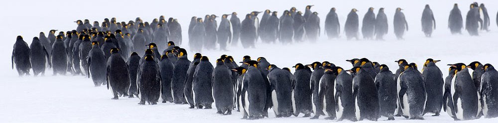
![[PENGUIN1]](http://si.wsj.net/public/resources/images/NA-BF553_PENGUI_F_20100419163939.jpg) Minden
Minden 


![[SB10001424052748704671904575194383287289928]](http://s.wsj.net/public/resources/images/OB-IF235_0418pe_D_20100419155418.jpg)
 Free Preview
;)
;)
;)
;)
;)